Welcome
Introduction
Thank you for taking the time to visit the online component of the Mitchell Area Master Transportation Plan (MTP) public meeting. We appreciate your input! In this first public meeting, the study team is looking for your help in identifying two key items:
- Transportation issues and needs throughout the Mitchell area to be addressed by this MTP
- Goals and priorities to be incorporated into the MTP
The public meeting website is organized into stations by transportation topic, similar to an open house, where you will have the opportunity to provide comments. Several tabs include an interactive map where you can identify site-specific transportation needs directly on a map. You can also complete our transportation survey and help identify goals and priorities for this study.
The comment period for this meeting extends through February 11, 2021.
Background
The South Dakota Department of Transportation, City of Mitchell, and Davison County have partnered in the development of a long-range Master Transportation Plan for the Mitchell area. This plan will help guide transportation decisions and investments for all primary modes of travel, including vehicle, bicycle, pedestrian, transit, and air. This multimodal study is currently in the preliminary stages of gathering information, conducting preliminary analyses, and gathering feedback from the public and area stakeholders to help define transportation issues and needs within the Mitchell Area.
Study Contacts
Jon Wiegand, P.E., PTOE, Consultant Project
Manager
jonathon.wiegand@hdrinc.com
| 605-782-8105
Steve Gramm, P.E., SDDOT Project Manager
steve.gramm@state.sd.us | 605-773-3281
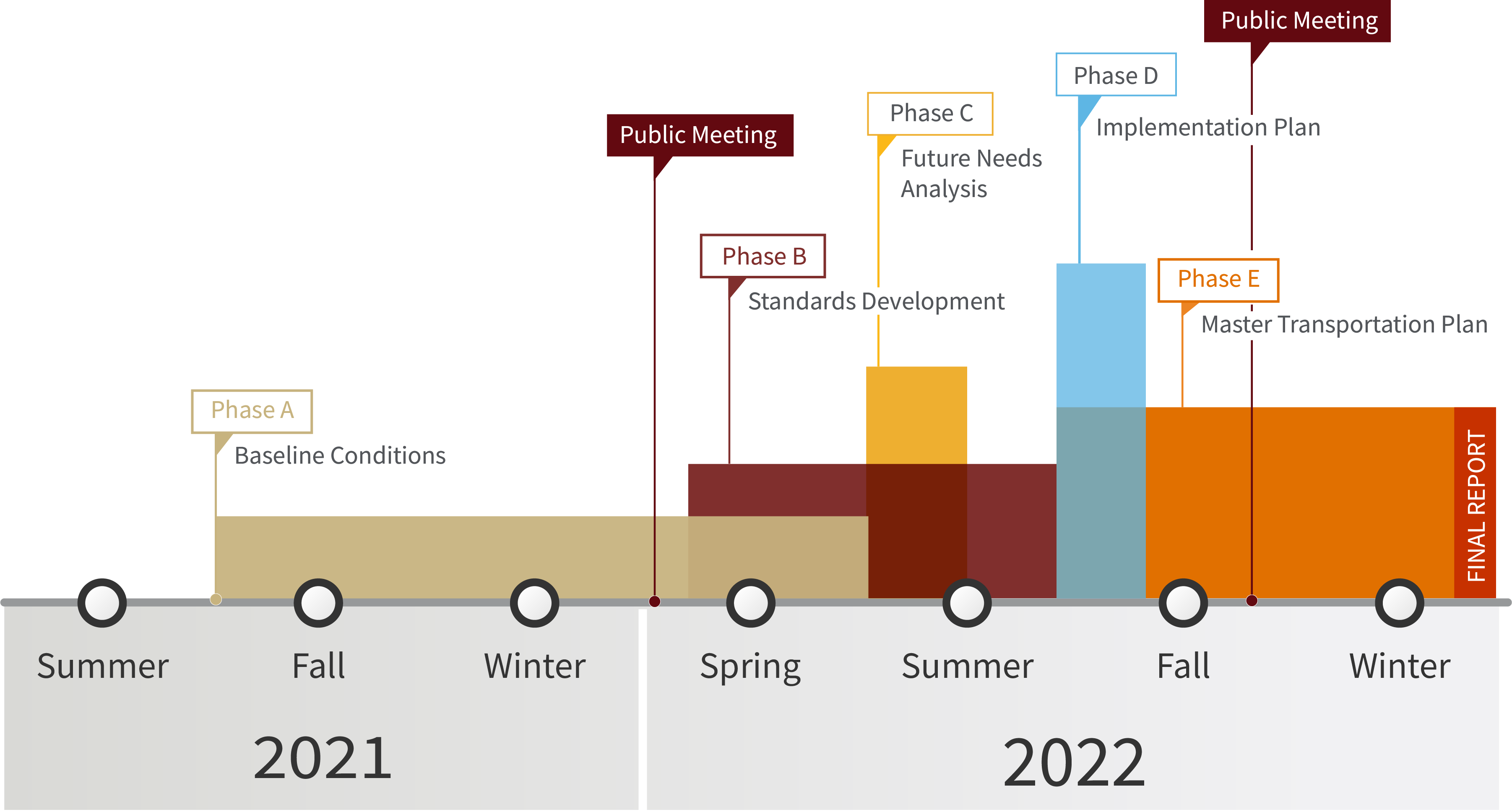
Study Schedule
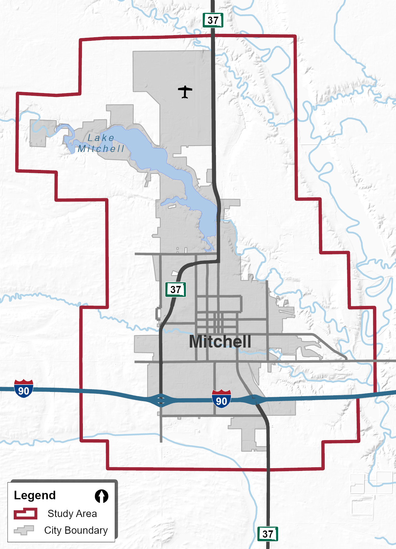
Study Area
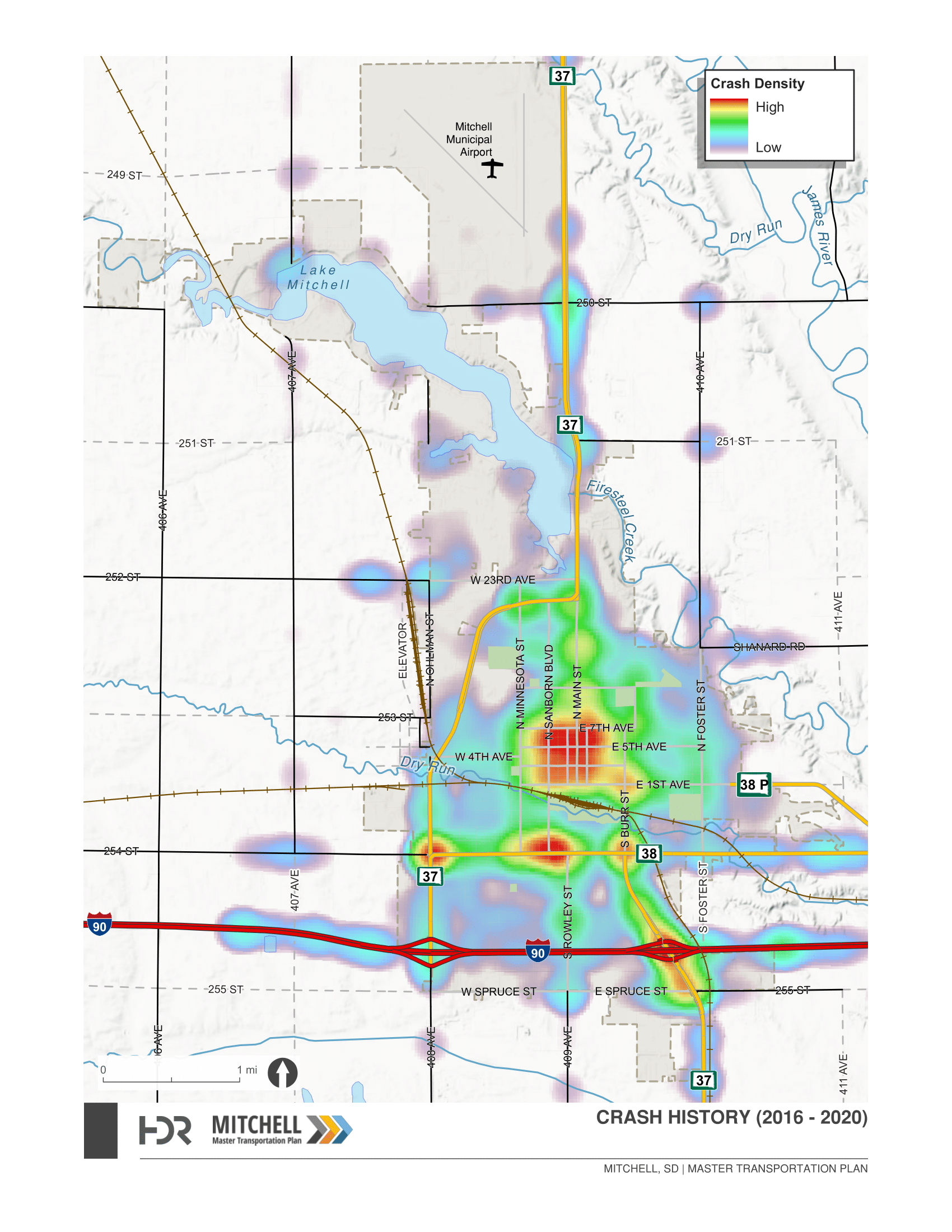
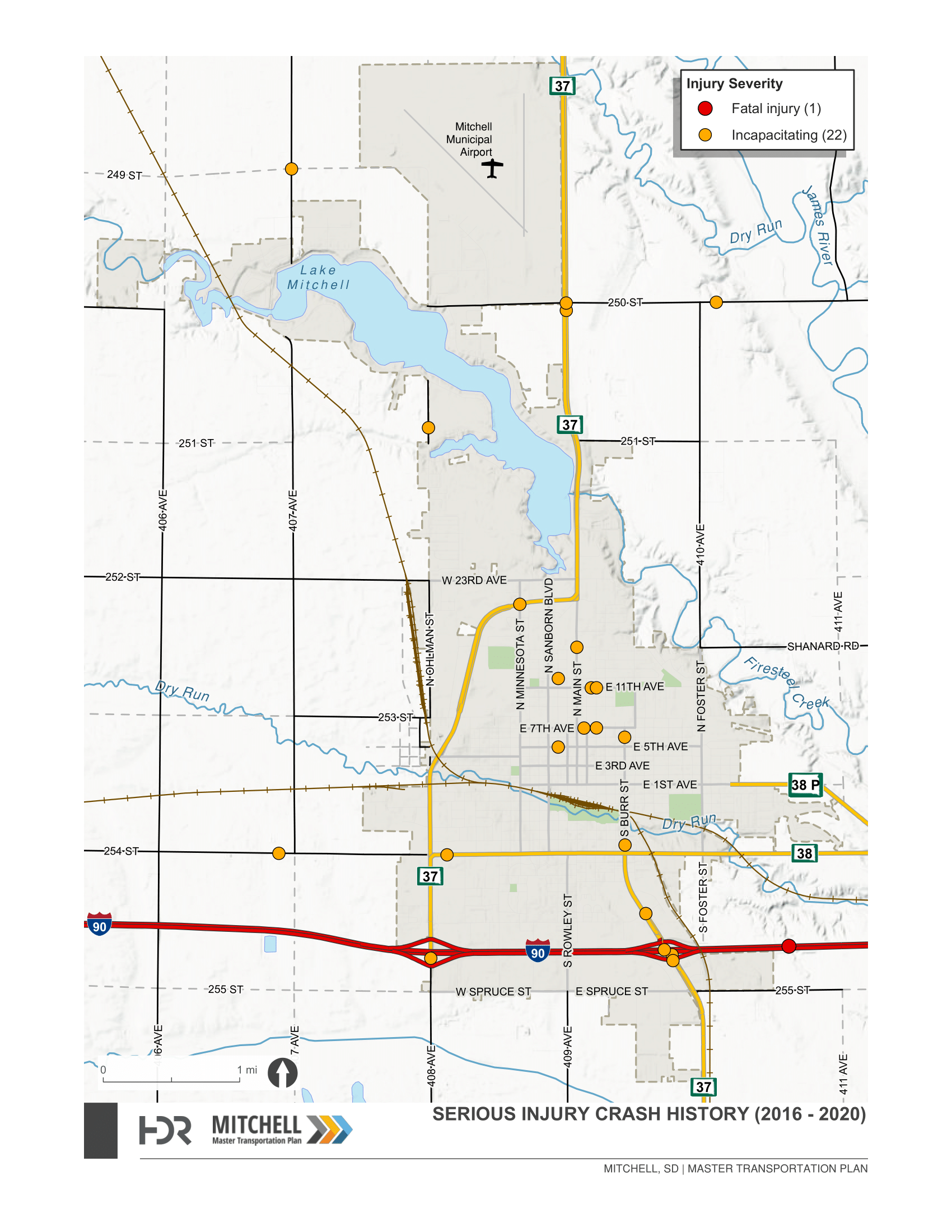
Traffic and Safety
Help us identify traffic and safety related transportation issues and needs to be addressed by the Mitchell Area Master Transportation Plan!
In the interactive map below, identify locations where you have concerns related to traffic and safety, such as:
 Safety (crashes, close-calls, etc.)
 Traffic congestion
  Speeding
 Turn lanes, additional lanes,
or medians
Turn lanes, additional lanes,
or medians Traffic signal improvements (new
signal, timing adjustments, signal
upgrade, etc.)
Traffic signal improvements (new
signal, timing adjustments, signal
upgrade, etc.)
Add a comment to a particular location by clicking on the “Add a Comment” link, drop a pin on the map and type your comments. For best results, view map in Chrome, Firefox, or Edge.
Other users of this map will only be able to see that you left a comment, and the details you provide will only be viewed by the Mitchell MTP project team.
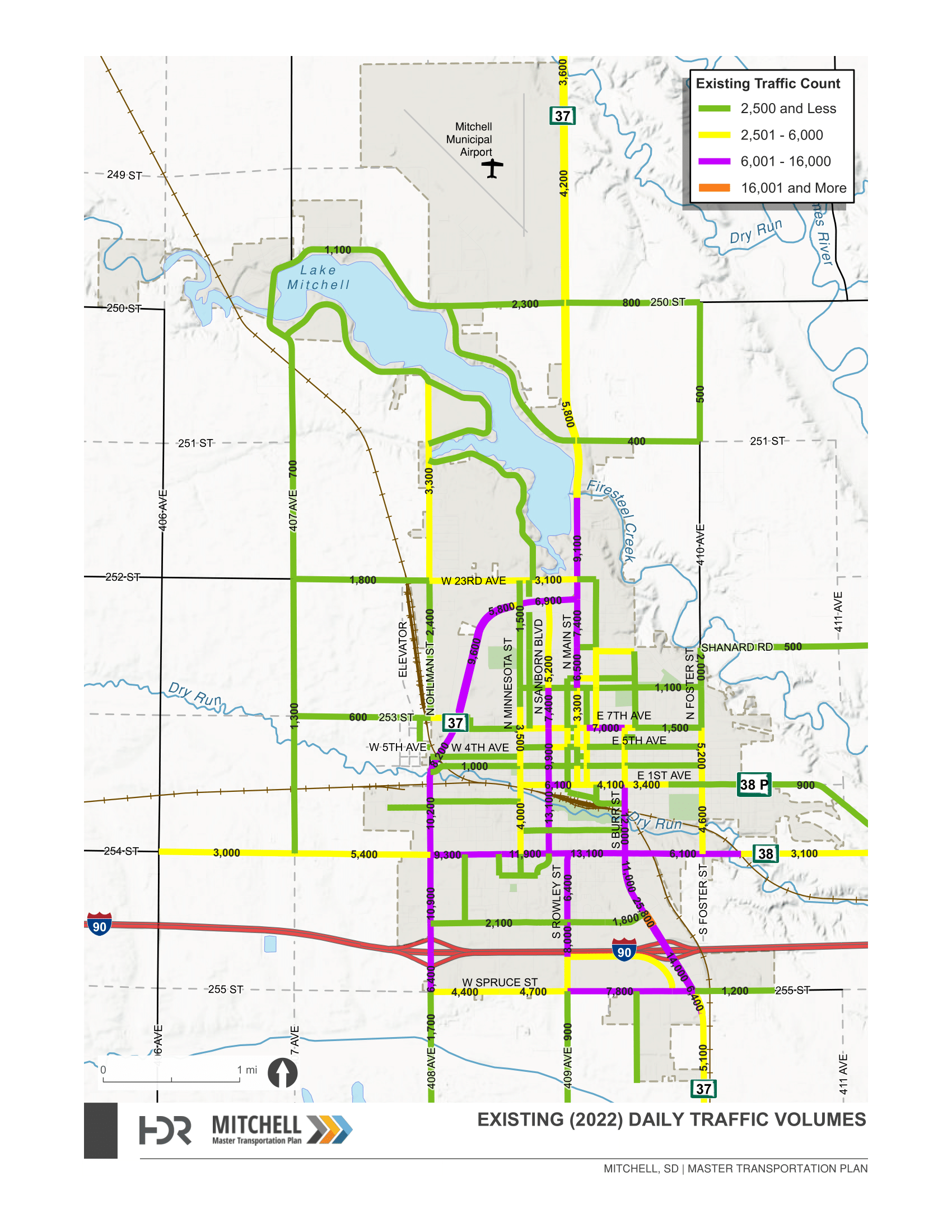
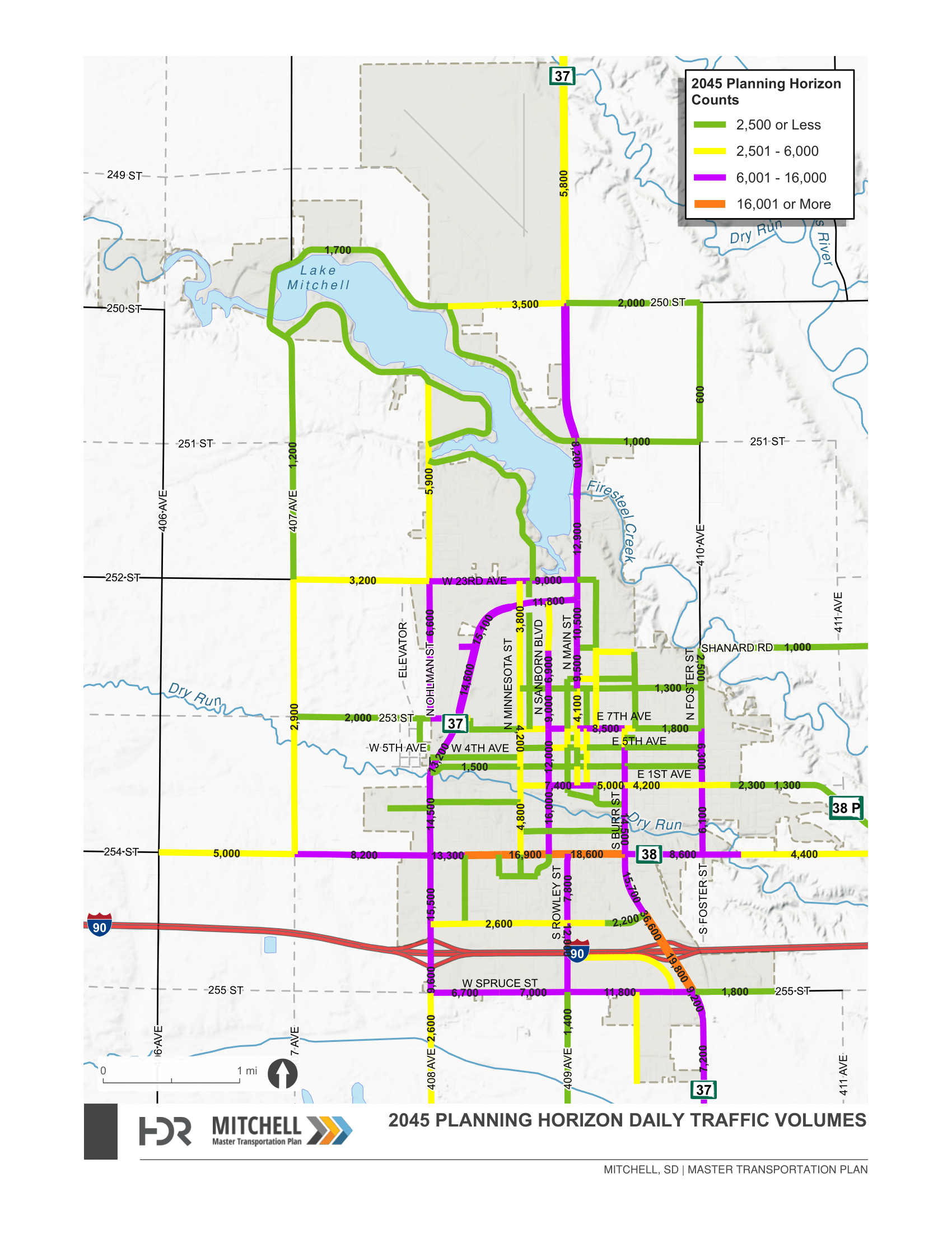
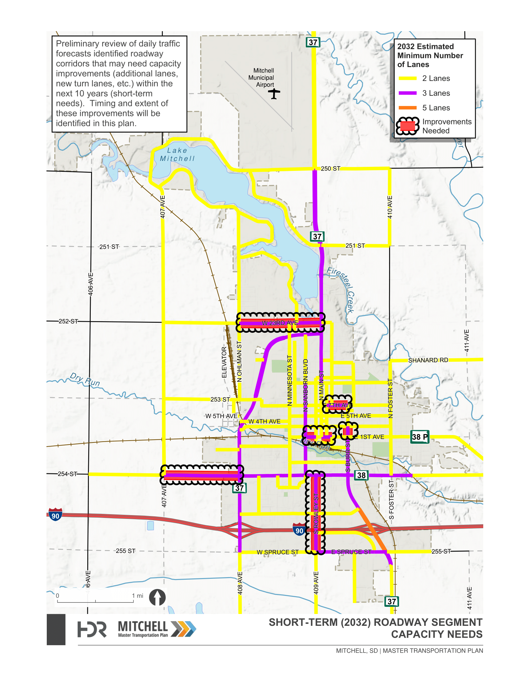
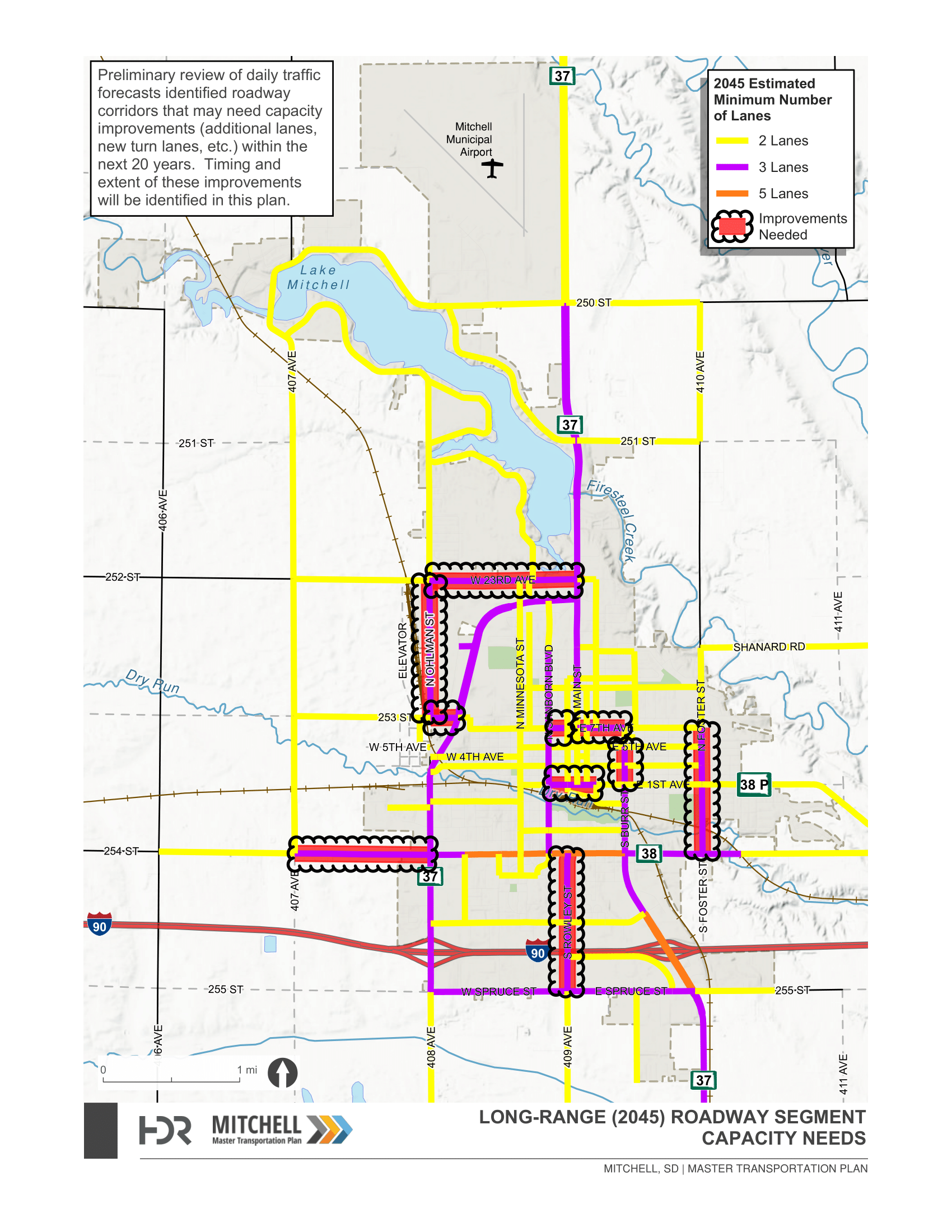
Reference Information
Click on the images below to open them in a new window.
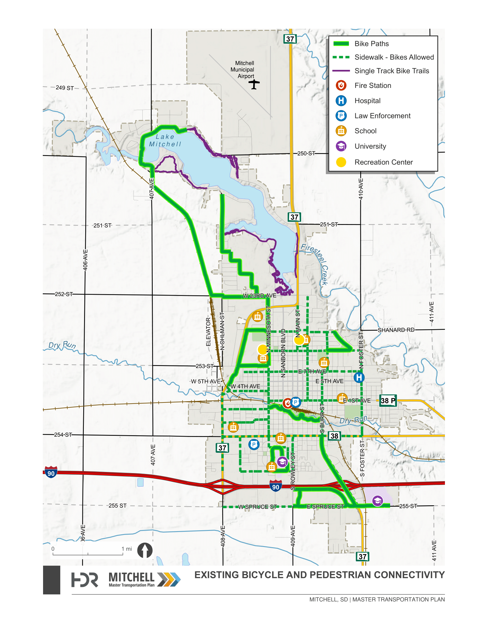
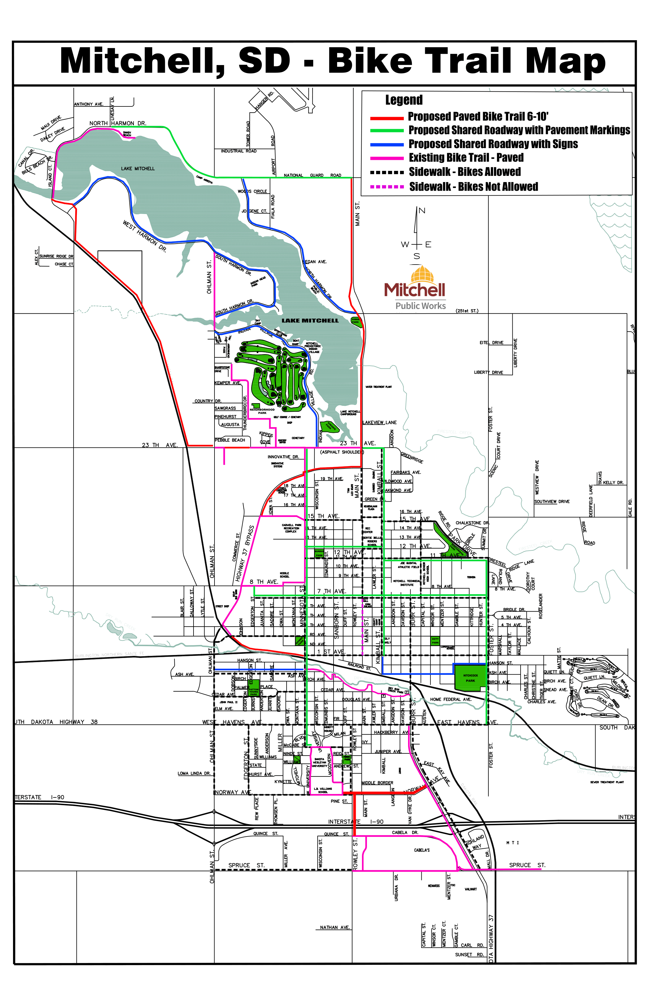
Bicycle and Pedestrian
Help us identify bicycle and pedestrian related transportation issues and needs to be addressed by the Mitchell Area Master Transportation Plan!
In the interactive map below, identify locations where you have concerns related to traffic and safety, such as:
 Future trail connections and extensions
 Gaps in sidewalk
 Sidewalk width or obstacles
 Street crossing improvements
Add a comment to a particular location by clicking on the “Add a Comment” link, drop a pin on the map and type your comments. For best results, view map in Chrome, Firefox, or Edge.
Other users of this map will only be able to see that you left a comment, and the details you provide will only be viewed by the Mitchell MTP project team.
Reference Information
Click on the images below to open them in a new window.
Travel Routes
Help us identify route related transportation issues and needs to be addressed by the Mitchell Area Master Transportation Plan!
In the interactive map below, identify locations where you have concerns related to specific routes you use when traveling throughout the Mitchell area, such as:
 Unofficial cut-through routes leading to
high volumes and speeds not supported by the cut-through route roadway
(neighborhoods, parking lots, etc.)
Unofficial cut-through routes leading to
high volumes and speeds not supported by the cut-through route roadway
(neighborhoods, parking lots, etc.) Truck/freight routes
 Wayfinding needs for tourists and unfamiliar drivers (what needs
wayfinding signage, what is under-identified, etc.)
Wayfinding needs for tourists and unfamiliar drivers (what needs
wayfinding signage, what is under-identified, etc.) Event traffic routes
 Transit fixed-route needs
Add a comment to a particular location by clicking on the “Add a Comment” link, drop a pin on the map and type your comments. For best results, view map in Chrome, Firefox, or Edge.
Other users of this map will only be able to see that you left a comment, and the details you provide will only be viewed by the Mitchell MTP project team.
Reference Information
Click on the images below to open them in a new window.
